Overview
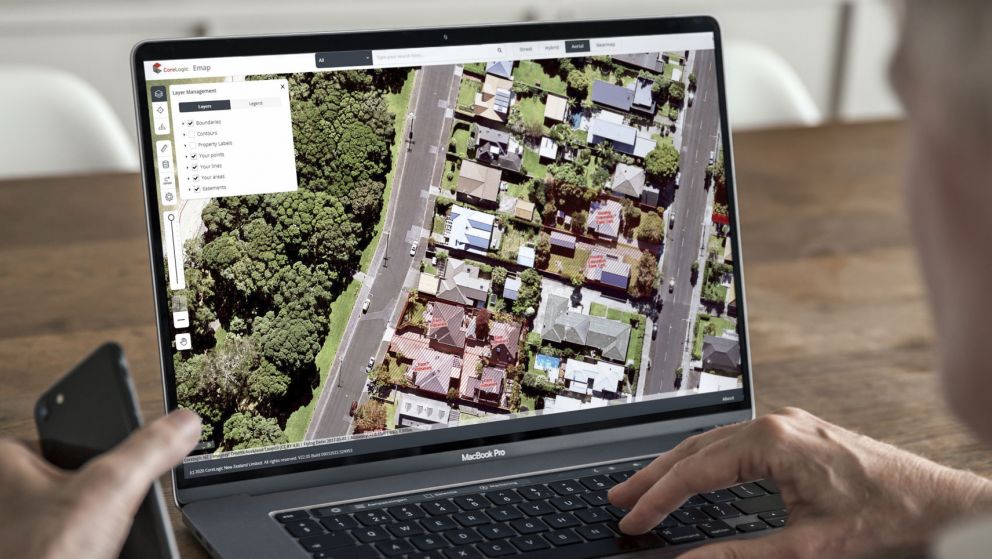
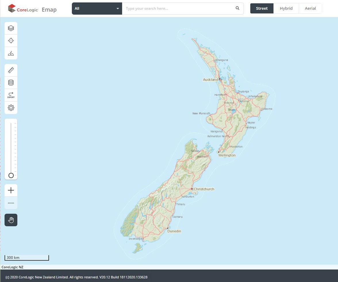
eMap is our map-based property research platform. It brings together interactive online maps, high-resolution imagery and New Zealand’s most comprehensive property and spatial data. What’s more, eMap includes functionality which allow you to integrate and overlay your own business data - designed to help you gain further insights and uncover opportunities.
We offer two versions of Emap – Standard and Advanced – giving you the flexibility to choose the features that better suit your needs.
Access the most comprehensive property and location data
eMap is powered by CoreLogic’s market-leading NZ MasterMap dataset, which is used by government departments, insurers and New Zealand’s largest telcos, and is trusted as a comprehensive source of location data.
eMap also provides access to our rich property data universe, including powerful property information such as ownership and title details, last sale price, contours and boundaries.
This data combined with CoreLogic’s market-leading mapping tools, is designed to support the visualisation of property market trends and help with understanding different property types, including complex properties like farms - to help you get the ‘bigger’ picture.
Our powerful property data covers over 99% of the NZ property market, with 200+ data sources and 20 years of property history.
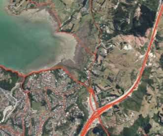
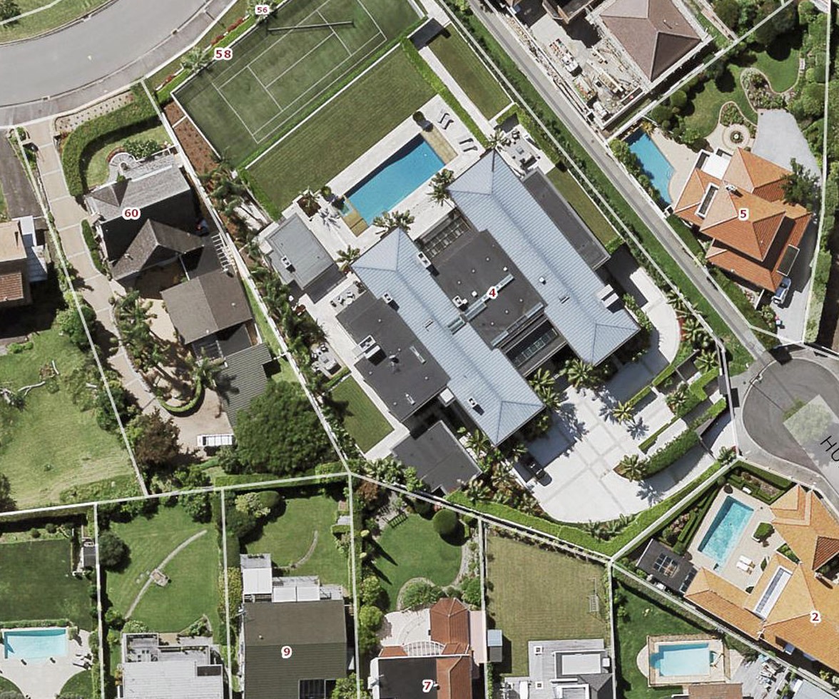
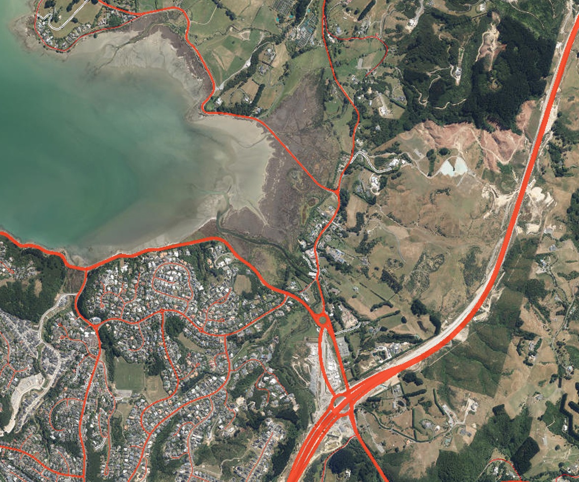
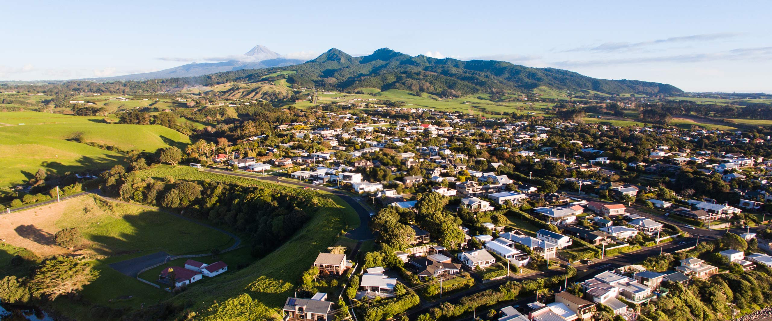
Full nationwide coverage of cloud-free, orthorectified aerial imagery – making it true and accurate for measurement purposes.
eMap’s data universe includes coverage of 2.4 million+ physical New Zealand property addresses. Our address data is regularly updated and is geo-coded and validated to help support data integrity.
4,000+ data changes are made every week across CoreLogic’s spatial data.
Government agencies, first responders and industries including telecommunications, utilities, insurance, legal and finance in New Zealand rely on CoreLogic’s location data.
eMap is powered by NZ MasterMap, which is maintained by a dedicated team of local experts, and is trusted as a comprehensive source of location data.

Explore a sample of CoreLogic's leading geospatial data through the interactive NZ MasterMap portal and experience for yourself how it can support smart decision-making


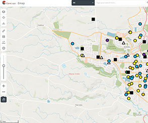
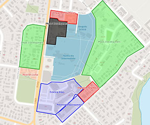
Better business planning: visualise market trends and opportunities
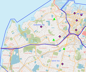
As a map-based research platform eMap lets you view data spatially, designed to help you visualise market trends and opportunities in areas of interest.
Better business planning: visualise market trends and opportunities
As a map-based research platform eMap lets you view data spatially, designed to help you visualise market trends and opportunities in areas of interest.
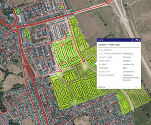
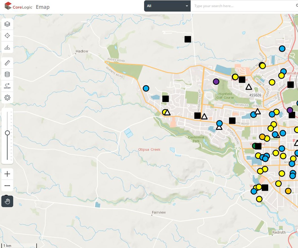
Access rich property information, including ownership and title details, last sale price, contours and boundaries, on a user-friendly mapping interface.
Mark out retail outlets and locations of infrastructure important to your business on the map – helping you make sure you’re well placed to service your customers.
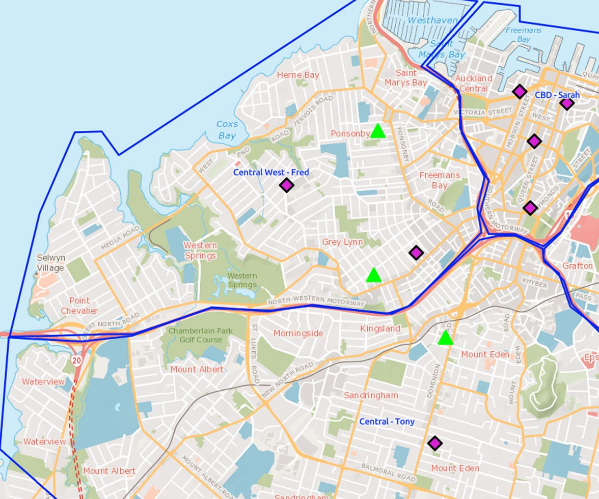
Emap Advanced enables you to add and customise your own business data- designed to make it easier to plan out your resources and visualise trends, growth areas and weak spots.
Emap Advanced only
Partner with the right people
Save time by accessing high quality, orthorectified aerial imagery, designed to make it easier to estimate distances, understand the location of physical elements, and to prepare plans for installation and maintenance work without need for site visits.
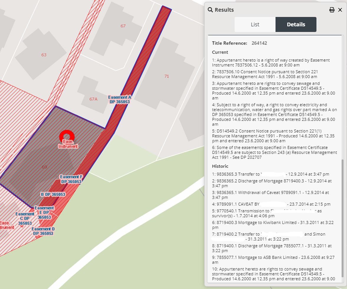
eMap can also help you assess properties more easily and efficiently, by making it easier to access ownership and boundary details, as well as more complex information such as easements. Plus, have the opportunity to apply your own expertise with eMap’s draw and measure tools.


Partner with the right people
Save time by accessing high quality, orthorectified aerial imagery, designed to make it easier to estimate distances, understand the location of physical elements, and to prepare plans for installation and maintenance work without need for site visits.
eMap can also help you assess properties more easily and efficiently, by making it easier to access ownership and boundary details, as well as more complex information such as easements. Plus, have the opportunity to apply your own expertise with eMap’s draw and measure tools.
See where the property boundary is in relation to other buildings, infrastructure or work that needs to be carried out.
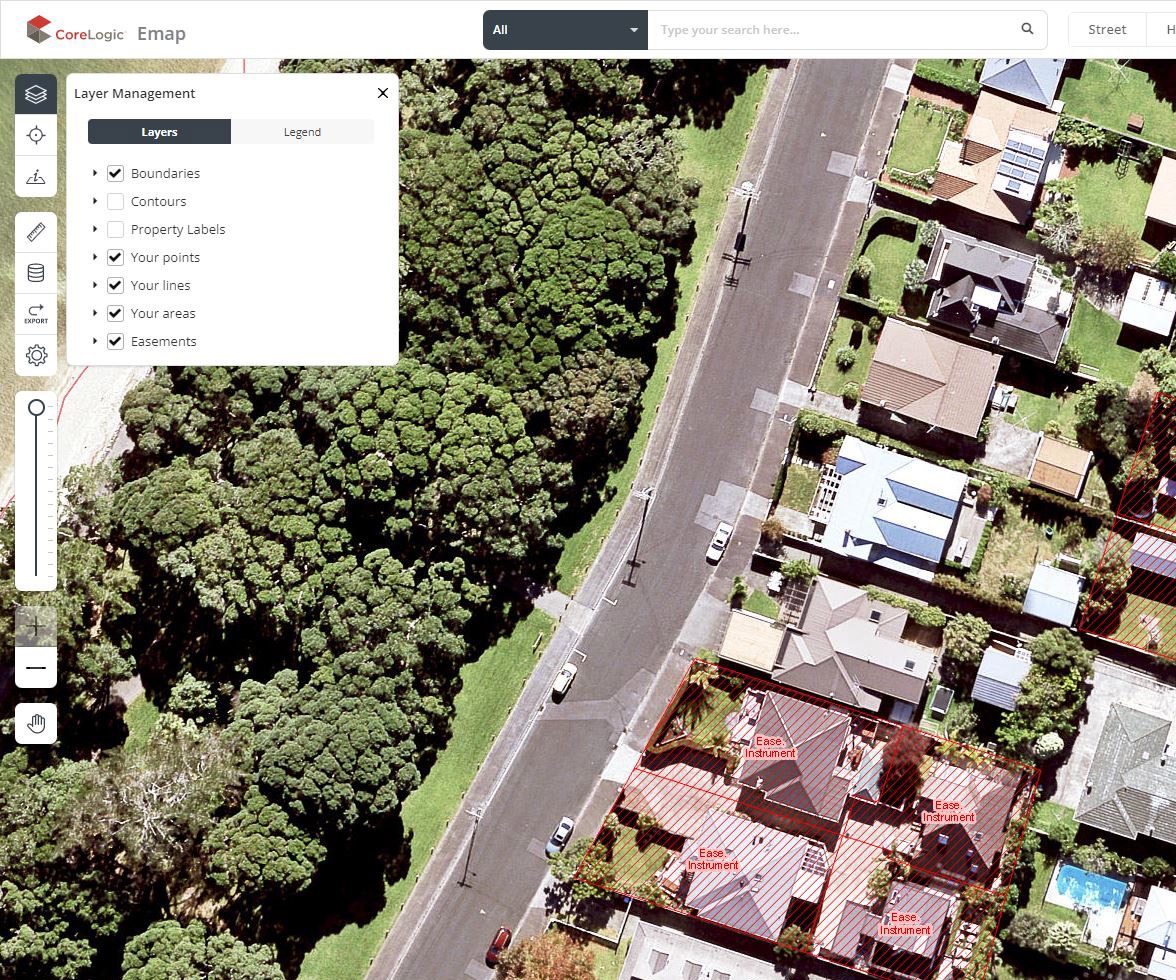
Easily find out who owns a property, making it easier to inform residents who may be impacted by installation or maintenance works.
Create detailed maps, highlighting and labelling key elements and measuring out distances or areas, with the option to download and include the map in client documentation.

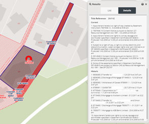
Visually assess title information, parcels, neighbours and boundaries, designed to help you more easily understand a property when it comes to conveyancing and sales, even for complex properties like farms.
Get a better understanding of transactions, interests in, or restrictions on a piece of land. You can view land parcels that have easements, along with their geometries and a detailed description of each easement
Emap Advanced only
After data is uploaded, all users on your account can access it – help save time and make sure everyone is working with the same information.
Emap Advanced only
Latest news and research
More News & Research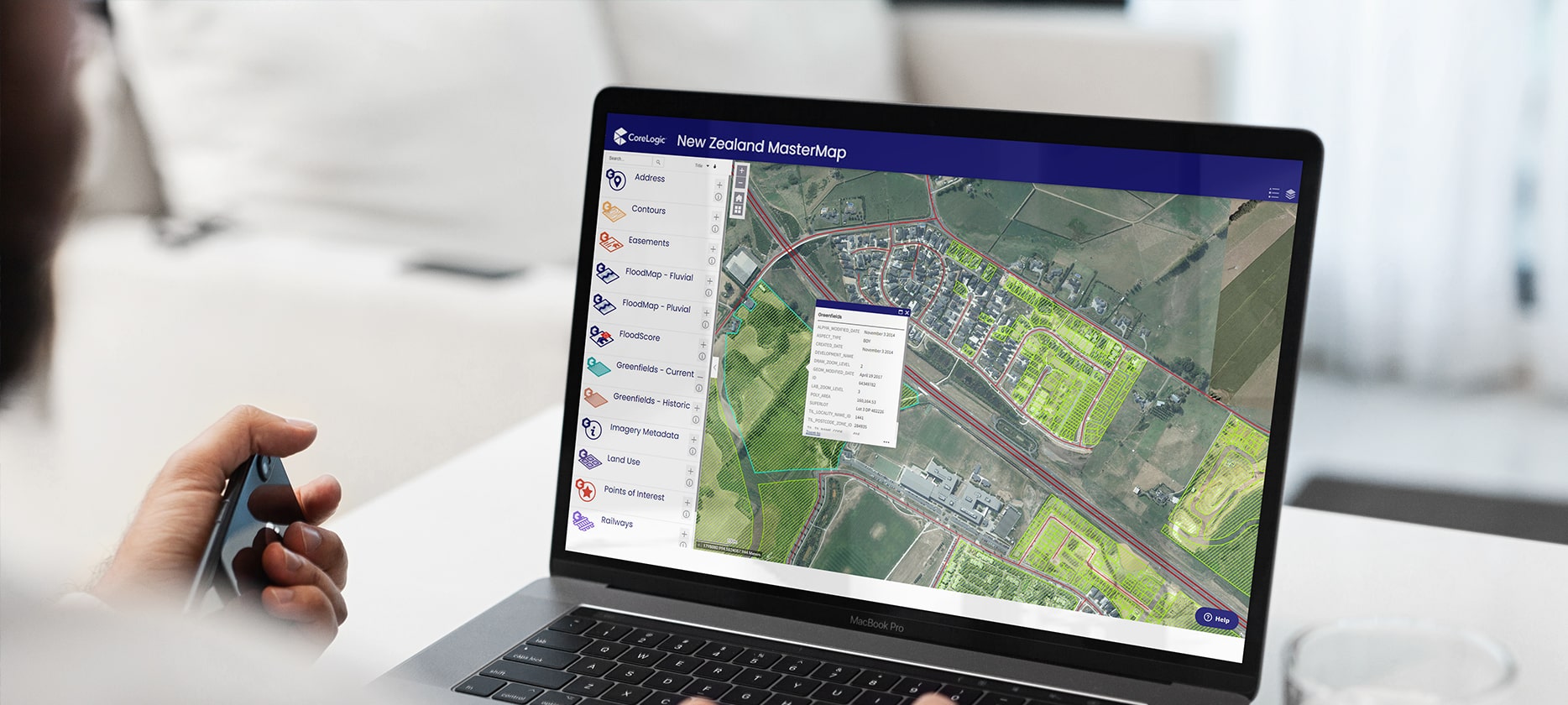
Experience the power of NZ’s most comprehensive geospatial data
Dig deep into CoreLogic's market-leading geospatial data with the interactive NZ MasterMap portal.


How can we help you?
Let's get this conversation started! Our team is here to provide you with more information and answer any questions you may have.