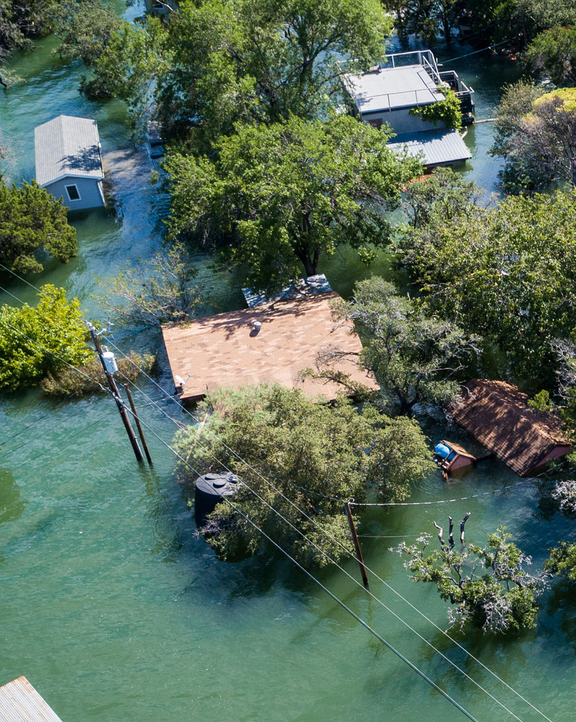
With flood risk increasing with climate change, the need for accurate, consistent flood risk modelling has never been more important.

Broad coverage and depth of detailModelling covers 100% of NZ, with 70% of...
Broad coverage and depth of detailModelling covers 100% of NZ, with 70% of...Modelling covers 100% of NZ, with 70% of properties at 5m urban resolution, modelled using LiDAR when available, and 8m grid resolution in rural regions .

Covers all major flood sourcesHelps with understanding flood risk from...
Covers all major flood sourcesHelps with understanding flood risk from...Helps with understanding flood risk from all the major types of flooding, which can be viewed individually or in combination over different return periods.

Flood defence data includedFlood defences are incorporated for over...
Flood defence data includedFlood defences are incorporated for over...Flood defences are incorporated for over 35,000 properties, designed to provide a more holistic view of risk for properties in New Zealand.

Overlay your own dataHave the ability to use NZ FloodMap in c...
Overlay your own dataHave the ability to use NZ FloodMap in c...Have the ability to use NZ FloodMap in conjunction with other datasets, including your own, or with CoreLogic BaseMaps to help visualise real world impact.


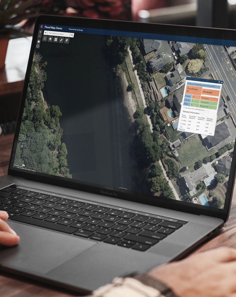
Explore a sample of NZ FloodMap data through the interactive NZ MasterMap portal and experience for yourself how it can support smart decision-making


A detailed view of flood risk throughout New Zealand
Offering access to a high level of detail of flood risk throughout New Zealand, NZ FloodMap and FloodScore are ideal for use across any sector that’s seeking to better understand flood risk.
NZ FloodMap and FloodScore are designed to help you to:
- assess concentration risk across your portfolio
- optimise policy pricing at a property level
- set exclusions and excess appropriate to the identified level of risk
- initiate conversations for risk mitigation with clients in identified flood zones

NZ FloodMap and FloodScore are designed to help you to:
- understand potential exposure across your lending portfolio
- be better informed for decision-making in the mortgage origination process
- assess the potential impact of flooding on bank assets for business continuity planning
- meet flood-related compliance obligations
NZ FloodMap and FloodScore are designed to help you to:
- enable emergency services to better visualise, assess and understand potential flood risk
- prepare for and manage the physical and social impact of flooding in communities
- understand how flooding could impact resources and infrastructure
- gather insights and evidence to support policy and planning decisions
NZ FloodMap and FloodScore are designed to help you to:
- identify existing potential flood impact on asset locations
- take flood risk into account when planning the location of future assets
- assess where customers could be affected if flooding was to cause service outages
- improve your ability to perform ‘lifeline’ obligations under the Civil Defence Emergency Management Act

A detailed view of flood risk throughout New Zealand
Offering access to a high level of detail of flood risk throughout New Zealand, NZ FloodMap and FloodScore are ideal for use across any sector that’s seeking to better understand flood risk.
NZ FloodMap and FloodScore are designed to help you to:
- assess concentration risk across your portfolio
- optimise policy pricing at a property level
- set exclusions and excess appropriate to the identified level of risk
- initiate conversations for risk mitigation with clients in identified flood zones
NZ FloodMap and FloodScore are designed to help you to:
- understand potential exposure across your lending portfolio
- be better informed for decision-making in the mortgage origination process
- assess the potential impact of flooding on bank assets for business continuity planning
- meet flood-related compliance obligations
NZ FloodMap and FloodScore are designed to help you to:
- enable emergency services to better visualise, assess and understand potential flood risk
- prepare for and manage the physical and social impact of flooding in communities
- understand how flooding could impact resources and infrastructure
- gather insights and evidence to support policy and planning decisions
NZ FloodMap and FloodScore are designed to help you to:
- identify existing potential flood impact on asset locations
- take flood risk into account when planning the location of future assets
- assess where customers could be affected if flooding was to cause service outages
- improve your ability to perform ‘lifeline’ obligations under the Civil Defence Emergency Management Act
How can you access NZ FloodMap?
NZ FloodMap is available and compatible with most GIS systems, including CoreLogic’s BaseMaps.