
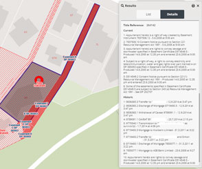
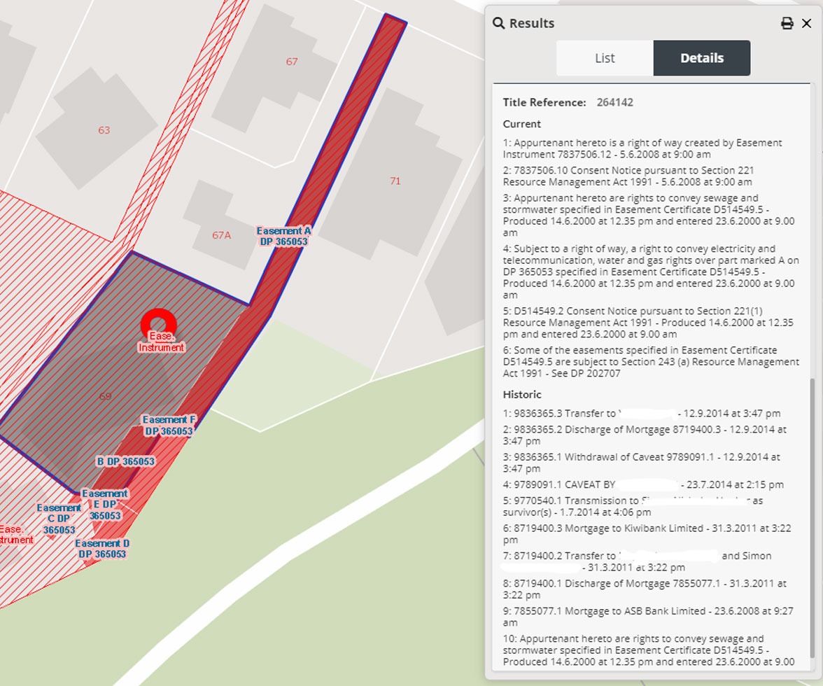
Geo-coded and validated - helping to offer the most accurate representation of an address location

Reviewed and verified weekly by our dedicated team of geospatial experts

Including CoreLogic-exclusive imagery, cloud-free and orthorectified (true and accurate for measurement purposes)
Best-in-class data supported by dedicated local mapping experts

Dedicated data maintenance teamOur local GIS experts are passionate abo...
Dedicated data maintenance teamOur local GIS experts are passionate abo...Our local GIS experts are passionate about data accuracy - helping you to get services, people and infrastructure to the right location

Flexible formatsData deliveries are available in multipl...
Flexible formatsData deliveries are available in multipl...Data deliveries are available in multiple file formats, including web mapping and feature access, API or via enterprise-grade data sharing platforms such as Snowflake

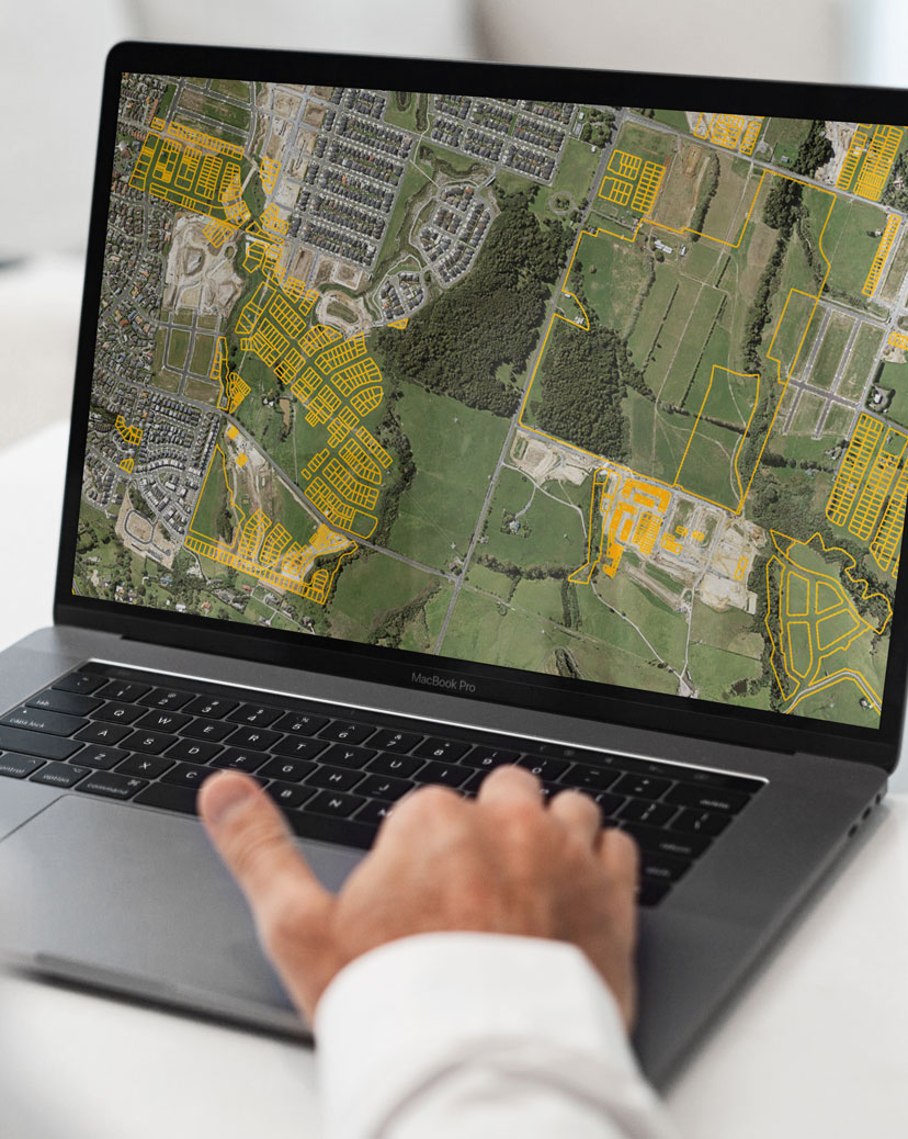
Rich data sourcesIncluding greenfield developments (plann...
Rich data sourcesIncluding greenfield developments (plann...Including greenfield developments (planned subdivisions), roading changes, land-use areas, points of interest, building consents, title records and address updates from infrastructure providers

In-house know-howOur team are experienced in a range of G...
In-house know-howOur team are experienced in a range of G...Our team are experienced in a range of GIS technologies and delivery mechanisms and are available as consultants to support your business


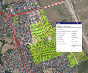
Explore a sample of CoreLogic's leading geospatial data through the interactive NZ MasterMap portal and experience for yourself how it can support smart decision-making


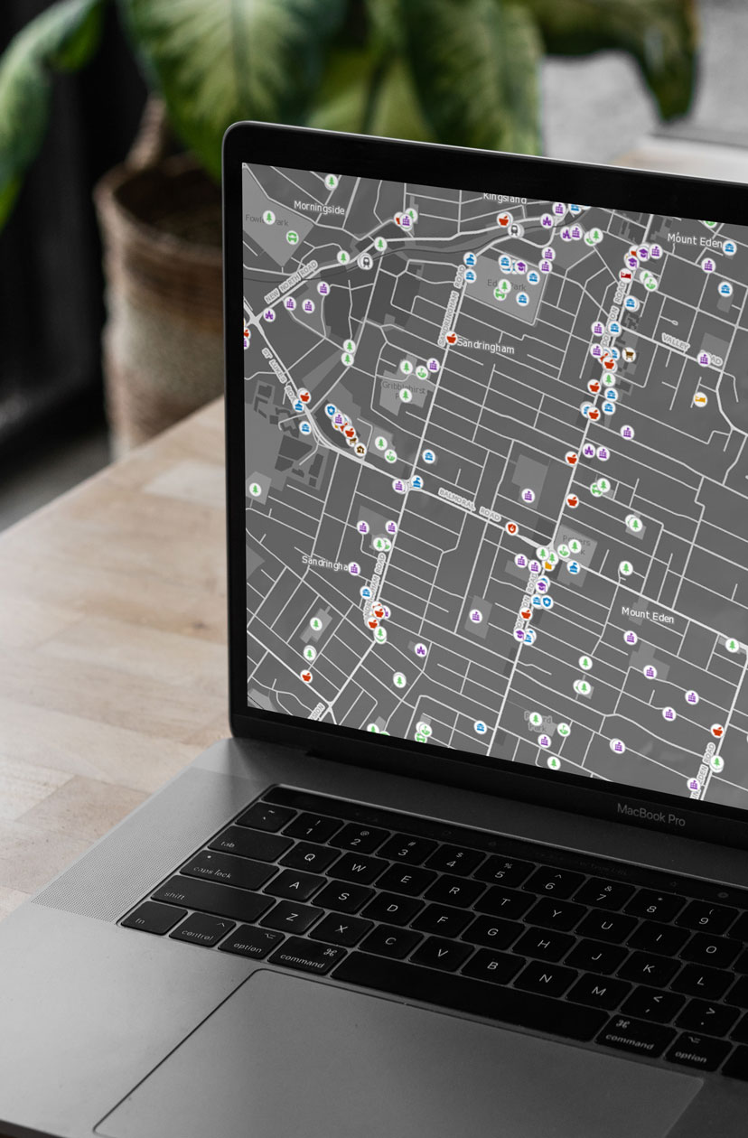
Essential spatial data for a comprehensive overview of New Zealand
Used to support the planning and provision of essential services that support Kiwis nationwide, our spatial data is used by telecommunications & energy providers, government agencies, insurers and first responders.
CoreLogic empowers government decision-makers to reinforce their economic, social, and environmental policymaking with data-driven insights.
Given our unique ability to not only provide the “what”, but also the “where”, when it comes to New Zealand property data, we help our customers understand behaviours and trends, and gain relevant context for their decision making.
Many of our customers provide essential services to New Zealanders, from broadband internet to power and gas.
By bringing together our market-leading property and location data, we help organisations in the telecommunications and utilities sectors to:
- manage their assets
- assess and mitigate risk
- plan out retail locations, infrastructure projects and maintenance work
- continue to provide the best possible service to Kiwis
Insurers use CoreLogic’s geospatial data, in combination with our comprehensive property data, to help them confidently approach risk assessment, underwriting decisions and the drafting of policy wording.
Geo-coded addressing can also provide a robust check to address points, helping insurers to identify and assess specific sites for risk and exposures.
Powered by CoreLogic’s geospatial capabilities, Property Guru’s innovative mapping technology helps you visualise recent sales and listings, measure boundaries and identify property features.
Overlay your own information with our geospatial data to enable the integration of planning and natural hazard data to further improve valuer insights and efficiency.
Property insights enhanced by location data
CoreLogic’s geospatial data underpins many of our products and solutions, helping to bring a contextual view to property by adding location and other related information.


Property insights enhanced by location data
CoreLogic’s geospatial data underpins many of our products and solutions, helping to bring a contextual view to property by adding location and other related information.
NZ MasterMap offers powerful spatial data insights. Used to support the planning and provision of essential services that support Kiwis nationwide, NZ MasterMap is the data that helps power New Zealand’s first responders.

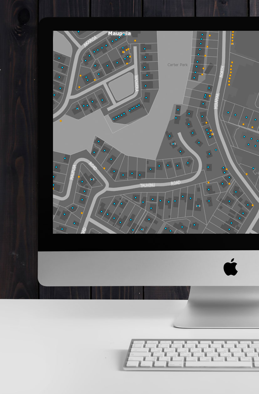
Offering rich address data that’s ready to be integrated into your website and internal systems, saving time and money while supporting a great customer experience.
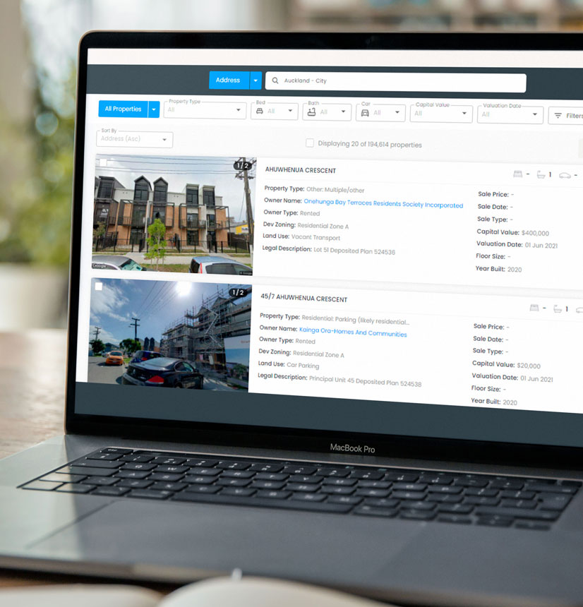
Our map-based property research platform. eMap brings together interactive online maps and high-resolution imagery with New Zealand’s most comprehensive property and spatial data.
NZ FloodMap is designed to provide a consistent spatial view of flood risk across New Zealand, for both large areas and individual properties.